Well, our streak of planning one thing and ending up doing something very different continues in full force. We woke up in Visalia, CA and were planning on heading for San Luis Obispo, spending the night there, checking it out (apparently it's the
"Happiest City in America!") and then heading up the famous Pacific Coast Highway on the way to Big Sur. As luck would have it, that isn't exactly how things turned out. When we left Visalia for SLO, I set the GPS to avoid interstates which added about 45 minutes to a 2 1/2 hour trip, but we preferred to see some of the out of the way places than drone on the interstate. We passed through quite a bit more farmland with everything from wheat, dairy (cow and goat), vineyards and a bunch of other types of farming in between. Our GPS just happened to dump us out on the coast at a little town called "Morro Bay," and that is where our plans began to change.
Since we were so excited to see the Pacific ocean, instead of making a left turn and going the final 12 miles to SLO, we decided to go through Morro Bay to the water and check it out. As it turns out, Morro Bay is a
very neat little beach town. It's not that big and it has a fantastic little harbor/beach front that is full of little restaurants, cafes, ocean view motels, touristy nic-nac shops, charter boats for whale watching, fishing and all other sorts of activities. The best way I can describe it is that it's like a cross between Rehobeth Beach, DE and Amity Island from Jaws. It's funny, but I've been to little beach towns all up and down the east coast from NY to FL, in Cornwall in the UK and now on the west coast and they all have a similar (if not exactly the same) feel to them. Michelle agreed and said you can add Italy to that list. Whilst making our way down through the town to the water we noticed something you cannot miss as it dominates the ocean front area of Morro Bay, and that's
Morro Rock. It is this
huge (as in 581 feet tall) vulcanic plug that gives Morro Bay it's name. It dominates your view from the harbor or the beach and the area surrounding it is a big park (the pictures below with Bella feeding the ground squirrel and the seagull trying to get our cheese were taken in that park). We were getting hungry for lunch at this point and decided to stop at the park at Morro Rock and have our lunch. We were summarily "attacked" by seagulls and a pack of ground squirrels for our food. The ground squirrels lived in burrows under the rocks all along the shore and they were not afraid of humans in the least. I've never seen so many squirrels in one place in my entire life. It was almost like a squirrel version of the movie, "The Birds." We retreated to our van to eat (it was also cold outside) and finished our lunch in peace.
We then decided to head to SLO to do a little sight-seeing. It's only a short drive down highway 1, so we were there in no time. When we first arrived I couldn't quite understand what all the fuss was about. It's a nice enough little city, but nothing jumped out at me as anything really special about it. Then we found the downtown area, which made a big difference. It's a walker's paradise. There are dozens and dozens of neat little shops, restaurants, coffee shops and all other sorts of small businesses as well as numerous parks. It sort of reminded me of Georgetown (in Washington, D.C.) from the 70's when I used to go their with my parents. I have heard that they close a large portion of the downtown area to motorized traffic and hold a "market night" that features farmers and other vendors. I bet that is alot of fun and I can see how well suited the area is to that sort of thing. I also noticed in driving through SLO it gives off a feeling of being comfortable with it's modesty. There is nothing seemingly flashy about SLO. It's almost as if the city is saying "what you see is what you get." and smiling while it says it. I can totally see the where the whole "happiest city in America" thing comes from. Having said that we decided not to stay the night in SLO.
As neat as SLO was, the things that would make SLO attractive to tourists (i.e. shopping and restaurants) just weren't high on our list of things to see and do (actually, they are close to the bottom, especially shopping). Also, I don't understand why you would establish a city so close to the ocean, but not actually on the ocean. It's about 7 miles from the ocean but you can't see the ocean anywhere from town at least not that I could see. Also, the hotels that were in the downtown district were rather expensive. When we compared them on Hotwire with beach view hotels in Morro Bay, the hotels in Morro Bay were 40-50% cheaper. Taking that into consideration and the fact that we actually preferred Morro Bay for it's beach town feel, we decided to stay in Morro Bay. We found a decent room, nothing special, but it did have an ocean view and was
very reasonably priced. We checked in, walked to a local restaurant on the waterfront, had dinner and went back to the room and turned in for the night.
We woke up the next AM, checked out of our hotel and walked down to the harbor front and had a small breakfast overlooking the harbor again. The seals out in the harbor where playing and bellowing back and forth. Bella got a kick out of that. We then jumped in the van and started up the Pacific Coast Highway toward Big Sur. About 20 miles up the road we saw a big sign that said "Road closed 46 miles ahead." We had heard that the PCH had been closed due to a landslide a few days earlier but we were hoping it would have been cleared by now. Really wanting to see the famed PCH and hoping that maybe it would be open by the time we got there, we went on ahead anyway. We stopped at a designated "Elephant Seal Viewing Area" and were able to see literally 100s of seals lying on the beach. 99% of them were not moving, if you didn't know better you might have thought they were dead, but every now and then, one would annoy another and they would start flapping around yelling at each other. Unfortunately we did not see any of the really big bulls, all we saw were the smaller females and adolescents.
We continued on up the coast and the weather, which had been overcast all day, began to get worse. It started to rain, not hard, but just enough so that you had to leave the windshield wipers on low. Even with the poor visibility, the PCH lived up to it's billing as a phenomenally beautiful drive. Unfortunately, the weather made it near impossible to get any decent pictures of the highways views (even when the rain subsided, the clouds remained). On the one side you have these towering hills and on the other side a great drop-off down to the ocean and ever few miles it seemed you would have a stream rushing out of a lush green canyon into the ocean. It was just simply gorgeous. And we only saw 1/2 of it. About 60 miles into our trip we came upon the road closed sign. We were able to get a picture of the landslide, and as you can see from below, it will not be passable for sometime. At this point we were just going to go back to route 46 and take 101 up the coast to the Monterey area and see if we wanted to drive back down PCH to see the other 1/2 of it maybe the next day. As luck would have it, I
really had to answer the call of nature, and with no bathroom in sight, I was forced to pull over in large pullout and run up in the woods to take care of business. As it turned out this pull out was for a trail that led to the "Nathaniel Owings Memorial Redwood Grove," although you could hardly make that out from the road. You could just see a small stream flowing out from the wood covered canyon. I followed the trail into a dark hole in the vegetation and about 50 yards in, it opened up to reveal two different streams with two gradual waterfalls, one about 200 feet and the other maybe 50, that came together to form the larger stream running out of the forest and into the ocean. There were redwoods all around the streams and some fairly large ones that had fallen and acted like bridges above the boulders strewn about the streams. It was really neat. I went back to the car and convinced Michelle to come check it out with the kids and as she walked out into the opening I heard "Wow!" pop out of her mouth. :-) We snapped a few pics, none of which really convey the feelings this little forest setting gave off. Fairytalish is the best way to describe it. You half expected to see a dwarf walk out from behind a redwood with a pale in his hand coming to get some water.
We hopped back in the van and headed back down the highway. Only a few miles down the road we came across a canyon with a waterfall way up high back in the forest. This could not be seen coming north on the PCH unless you looked back over your shoulder as you passed it. There was a pull-off here as well, so I decided to go and check it out quickly by myself to see if it was worth getting everyone out of the car for. This hike was about 5 times as long as the previous one (which was very short), but it was worth it. A couple hundred yards in to the trail, there is a sign saying "Trail" and pointing to the right, but, there is clearly a well worn path to the left. I can tell that the path to the right is going to go near the top of the waterfall and it's obvious that is going to be much too hard and long to take Michelle and the kids on (in the rain no less), so I take the left unmarked trail to see if I can make it to the base of the waterfall. I head about 50 yards up that trail, cross a few little streams and head into another dark hole in the vegetation and on the other side it opens up into this bizarre (yet beautiful) setting of ginormous rocks and wavy branched trees that are all seemingly tangled together. It's really odd, because from the road there is no indication that there is anything like this back here. It's very dark (it's overcast and even if it was sunny, the tree canopy is very thick) and almost spooky because the size of the rocks and trees and there odd shapes make for all kinds of hiding places. Still, the setting was so fantastic, I literally let out a little "woohoo" when I saw it...then was quickly embarrassed when I realized someone else could be around and might have heard my exuberance. Lucky for me, nobody was there, or at least I never saw them. :-) I could see the waterfall, which was
much bigger than it appeared from the road behind the largest of these rocks (the biggest were literally the size of small houses, most were car sized). I could not easily get to the very base of the waterfall, so I made my way, through and over the large rocks down to the little river about 50 yards from the base of the waterfall and took a few pics in case Michelle did not want to come back with me (Again, the pics just do not convey what it's like in person). From this viewpoint, there were several sizable pools of water that would have been great for swimming had it not been for the cool temperatures. This setting was almost mystical. If the other setting had you envisioning dwarfs, this one might have had you envisioning a unicorn stepping out of the woods to drink from the pools created by the waterfall. It was just very very cool. I ran back to the car to tell Michelle about it. She was not sure if she wanted to make the hike, but after hearing my description, Bella begged to go and Michelle came along (I got to carry Aldous.). Upon walking through the path that lead to the opening showing the massive rocks and trees with the waterfall behind it I could here Michelle gasp...she later said she almost teared at the sight of it. I think it was the surprise as much as the beauty that elicited the emotional response. There is just nothing to indicate from the road that something this differently beautiful is only a couple hundred yards away. I took a look at getting around those massive boulders to the base of the waterfall, but there was no way I could do it with Aldie on my back and Michelle and Bella in tow, so we headed out after looking around for a few more minutes. I love the ocean, and the PCH is beautiful in and of itself, but for me, it was these waterfalls and their settings, practically unseen from the road, that made this day so cool. And without that landslide, we never would have turned back and never would have seen them.
These two little sojourns took up a couple of hours so we realized that we were not going to make it back up the coast this evening. Instead we decided to come back to Morro Bay (I told ya we liked this place) and get another room for the night. While we were walking to dinner last night I saw a hotel with a pool and hot tub (ours had neither) and Bellas
loves pools and/or hot tubs. Given that, I went to the hotel and was met by the owner Alex and asked him his rate. It was a very reasonable rate, but not quite as good as the one we had th previous night (which was a Priceline deal btw). I told him what I paid the night before and he agreed to match it based on the fact that he wanted to keep a customer (his words) and the weather was terrible. He's a smart guy and very nice to talk too. It's called Breakers Motel in downtown Morro Bay and it has a great view of the ocean and Morro Rock. I told him I'd mention him in the blog I was doing as a thanks for the great rate. As it turns out, the room was nicer and cleaner than the one we had the night before. Thanks Alex!
Not sure exactly what our plans are for tomorrow, but I'm not sure it much matters. We always manage to find something fun to do/see no matter what. :)
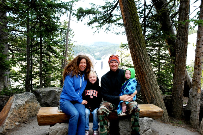
Here are a few pics...
 |
| Morro Bay beach. |
 |
| Morro Rock. This picture makes it seem smaller than it is because the boats in the picture are so much closer to the camera than the rock is. I'd say Morro rock is anywhere from .5-1 mile behind those boats. |
 |
| Bella with a mermaid friend in the harbor area of Morro Bay. |
 |
| This is a big platform out in the middle of Morro Bay harbor the seals gather on. I can hear them bellowing every so often even as I type this. |
 |
| Bella and Aldie on a couple of "horses" down on the waterfront. |
 |
| You can't tell, but that cheese is on the dashboard of our van and that seagull is on the hood trying to get to it. It was pecking our windshield like crazy...till I turned on the windshield wipers. |
 |
| This was the larger of the two waterfalls in the Forest at the Nathaniel Owings Memorial Redwood Grove. |
 |
| In the lower right of this pic is the entrance to the grove...it's hard to see even in person. |
 |
| Seals as far as the eye can see. |
 |
| One of Bella's little squirrely friends... :-) |
 |
| This is looking out from the grove...the PCH is about 100 yards straight ahead. |
 |
| This is the view from the ocean side of the PCH right where the grove was. |
 |
| A couple of female seals arguing over something. |
 |
| Random good luck pic....there has to be a 4 leafer in there somewhere! |
 |
| This is as close as we could get to the landslide that covered the road. I'm not sure how far away that was...but the next pic will give you some scale of how large it was. |
 |
| This is he same pic as above, only it's been cropped to try and show the landslide in detail. Notice how small the bulldozer and the pickup truck are in front of the landslide...and I think they were another couple hundred yards closer to the camera than the landslide was too. |
 |
| This was the waterfall from the second hike...it does not do the waterfall justice. That water was not rolling down, it was forcefully shooting down to the main pool which you can't see in this pic. |
 |
| A view of the waterfall between two of the boulders. |
 |
| This was the view from the road...nothing particularly special. It was very deceiving. |
 |
| Bella, Aldie and I mulling a way around the rocks to get to the base of the waterfall. These were the smaller rocks. :) |
 |
| Our single picture of the famed PCH coastline. The overcast day just did not lend itself to taking decent pics of the coastline, so we just enjoyed it in person and let the camera rest for the most part. |